Showing posts with label google earth. Show all posts

2009-06-12

Visit DisneyLand Paris Virtually

Clipped from: Visit DisneyLand Paris Using Google Street View
Google Operating System

Visit DisneyLand Paris Using Google Street View


Disneyland Paris is the first amusement park available in Google Street View. "Last October, as the last few rays of sunlight remained high enough in the sky, Disneyland Paris opened its gates early to our Street View car to capture some of the magic at street-level. We drove up Main Street USA (outside of Paris!), through Adventureland, and around Fantasyland and even in Walt Disney Studios Park," explains Google.


View Larger Map
You can also view an impressive 3D model of Disneyland Paris in Google Earth. "More than 85,000 photos (450GB worth) were taken over a 20 day period for this project. The castle alone is comprised of over 354 textures derived from over 2,000 photos. (...) There are over 500 unique landscape elements that were created to make the park look as realistic as possible."
Clipped from: YouTube - Announcing 3D Disneyland Resort Paris - in Google Earth


Sources:
  1. Visit DisneyLand Paris Using Google Street View
  2. Google Maps
Related:
  1. Google LatLong: Disneyland Paris in Google Earth
  2. Disneyland Resort® Paris, enter the magic of Disneyland® Paris in France
  3. Disneyland Paris

2009-06-08

Guggenheim and Google Join for Shelter Design Competition

clipped from www.nytimes.com
New York Times

Think Small: Design a Tiny Shelter Online

On Monday the Solomon R. Guggenheim Museum and Google will announce a global, online design competition that invites the public to use Google Earth and Google SketchUp to design virtual 3-D shelters. The contest, Design It: Shelter Competition, will accept submissions through Aug. 23. Amateur and professional designers can visit guggenheim.org for information on how to enter, choose a location on Google Earth and use SketchUp software to create an original design for a 100-square-foot living and work space.
clipped from www.guggenheim.org

Design It: Shelter Competition

Why shelters?

The competition is an extension of Learning By Doing, an exhibition in the Guggenheim Museum Sackler Center for Arts Education that features plans, photographs, and models of student-built shelters from the Frank Lloyd Wright School of Architecture. For the past seven decades, students at this school have taken on the challenge of designing, building, and living in small shelters nestled in the landscapes of the school’s Arizona and Wisconsin campuses. In working on these shelters, students consider human needs for safety and comfort, as well as the relationship between architecture and place.

Design It: Shelter Competition opens up the project to you. If you could build a shelter anywhere in the world, where would it be? How would you design it to respond to the surrounding environment?
clipped from www.guggenheim.org

Learning By Doing


Design It:
Shelter Competition

design it: shelter competition

Design, submit, and view shelters.

The Official Google Blog - Insights from Googlers into our products, technology and the Google culture
Unlike the Taliesin assignment, the shelters in this competition are virtual. To enter, use Google SketchUp to design a small structure where someone might sleep and work. Your shelter should be created for a specific site anywhere in the world and geo-located in Google Earth. It also should conform to size constraints and must not include running water, gas or electricity. When you're done with your design, upload it to the Google 3D Warehouse, then fill out the submission form on the Guggenheim website.
clipped from sketchup.google.comGoogle SketchUp

You can use Google SketchUp to create, modify and share 3D models.

Learn more about Google SketchUp »
New! Build models and add them to
Google Earth

clipped from sketchup.google.com

blog it

Sources:
  1. Arts, Briefly - Think Small - Design a Tiny Shelter Online - NYTimes.com
  2. Design It: Shelter Competition
  3. YouTube - Shelter Competition - Getting Started
  4. On View Now
  5. How to Enter
  6. Official Google Blog: Design It Shelter Competition: Unleash your inner architect
  7. Google SketchUp
  8. Google SketchUp
Related:
  1. Google Earth
  2. 3D Warehouse
  3. Gimme Shelter! Google and Guggenheim Get Sketchy | The New York Observer

2008-10-11

Google's GeoEye-1 Satellite

GeoEye Inc successfully launched its new GeoEye-1 satellite, which will provide Google Earth users and others the highest-resolution commercial color satellite imagery on the market.
clipped from wattsupwiththat.com

Google Earth gets a new space eye

Satellite Imaging Corp.
Satellite Imaging Corporation

About the GeoEye-1 Satellite

The GeoEye-1 Satellite sensor was developed by GeoEye and features the most sophisticated technology ever used in a commercial remote sensing system.
GeoEye-1 is capable of acquiring image data at 0.41 meter panchromatic (B&W) and 1.65 meter multispectral resolution. It also features a revisit time of less than three days, as well as the ability to locate an object within just three meters of its physical location.
This newly developed sensor is optimized for large projects, as it can collect over 350,000 square kilometers of pan-sharpened multispectral satellite imagery every day.
clipped from wattsupwiththat.com

GeoEye-1 Satellite Images

GeoEye-1 Satellite Image of Kutztown University
clipped from uk.youtube.com

Launch of the GeoEye-1 satellite aboard a Delta II Rocket

clipped from uk.youtube.com

Breaking: Satellite for Google Earth Blasts off in Californi

An unedited animation provided by GeoEye of the satellite and the means by which it scans images of earth.
blog it
Related:
Google Earth gets a new space eye « Watts Up With That?
 Satellite Images and Geospatial Data for GIS & Mapping Applications
 GeoEye-1 Satellite Imagery and Satellite Sensor Specifications | Satellite Imaging Corp
 CrunchGear » Archive » First photo from Google’s GeoEye-1 satellite released
 GeoEye Releases First Image Collected by Its New GeoEye-1 Earth-Imaging Satellite - Oct 08, 2008
 Google signs exclusive satellite deal - vnunet.com
 Google's Super Satellite Captures First Image | Wired Science from Wired.com

2008-05-24

Google Ocean

clipped from scienceblogs.com

A motion in Google ocean

According to Cnet's story Google diving into 3D mapping..., soon we'll all be able to get in a submarine and fly-through canyons to see the underwater world in high resolution the way marine scientists do. The new product will be an assimilation of improved satellite altimetry, multibeam echosounder technology, and other declassified information to allow unprecedented insight to the ocean realm.
clipped from news.cnet.com
CNET.com

This is an image of a bathymetry map that shows the depth of the sea floor. It is based on sparse ship soundings and satellite altimeter measurements of subtle bumps and dips in the ocean surface which are produced by tiny variations in the pull of gravity.

(Credit: David Sandwell and Walter Smith/Scripps Institute of Oceanography)
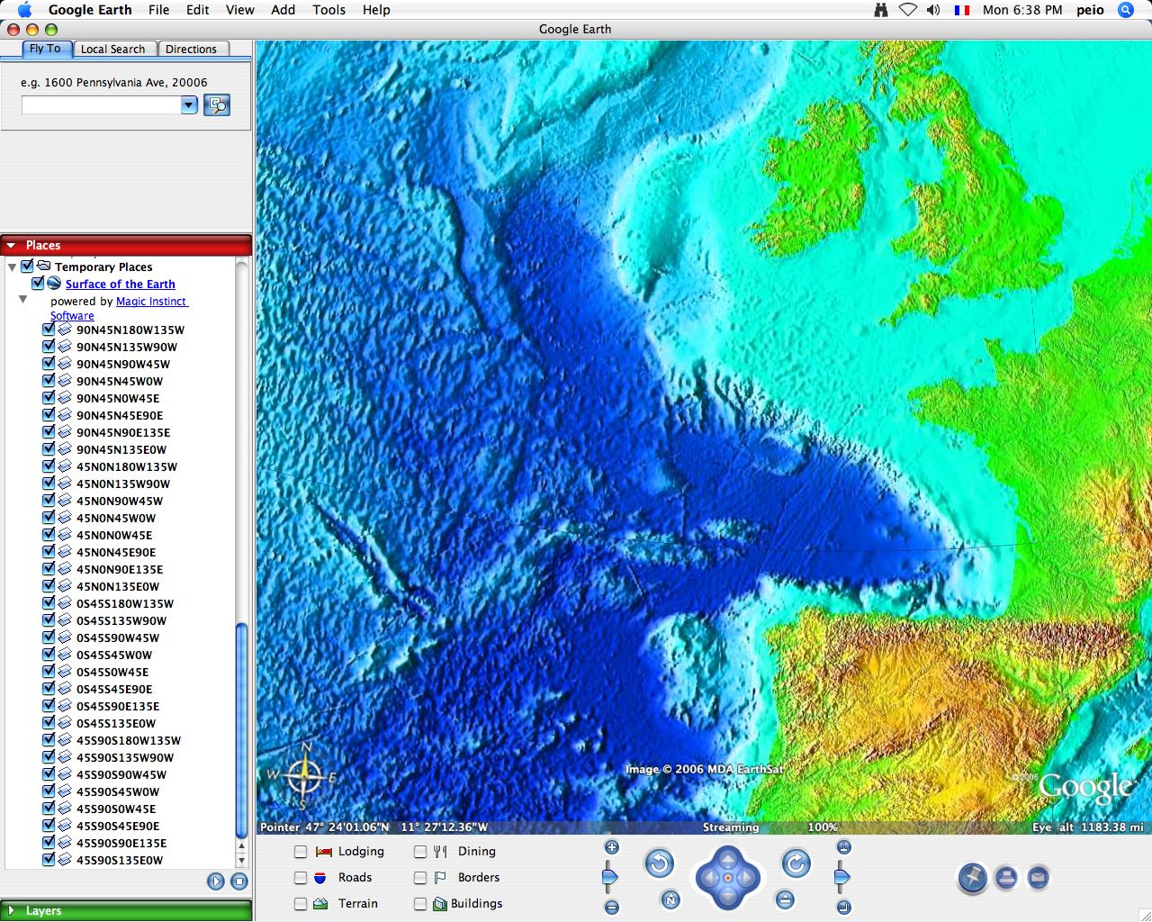
The tool, however, is not to be confused with the "Google Ocean" project by France-based Magic Instinct Software that uses Google Earth as a visualization tool for marine data.
clipped from www.justmagic.com
Bathymetry


Open this Placemark

Weather


Open this Placemark


blog it

2008-05-03

4D Ionosphere on Google Earth

NASA has just released CAPS, which is short for Communication Alert and Prediction System. This system enables that anyone can get a model of the Earth’s Ionosphere live.
clipped from science.nasa.gov
NASA - National Aeronautics and Space Administration Science@NASA Web Site
4D Ionosphere
April 30, 2008: Today, NASA-funded researchers released
to the general public a new "4D" live model of Earth's
ionosphere. Without leaving home, anyone can fly through the
layer of ionized gas that encircles Earth at the edge of space
itself. All that's required is a connection to the Internet.
clipped from science.nasa.gov
How to Launch the 4D Ionosphere
"One, download and install Google Earth."
"Two, visit our web site and click on the link 'Total Electron Content.'"

Wait for the file to load and presto—you're flying through the ionosphere. A typical screenshot looks like this:


blog it

via: CAPS: A '4D' Model of our Ionosphere - Instablogs
Related:
NASA - Explore the Ionosphere (from the safety of your own home)
NASA - How to Launch the 4D Ionosphere
CAPS
CAPS - Communication Alert Planning System

2008-04-20

Dynamic data in Google Earth

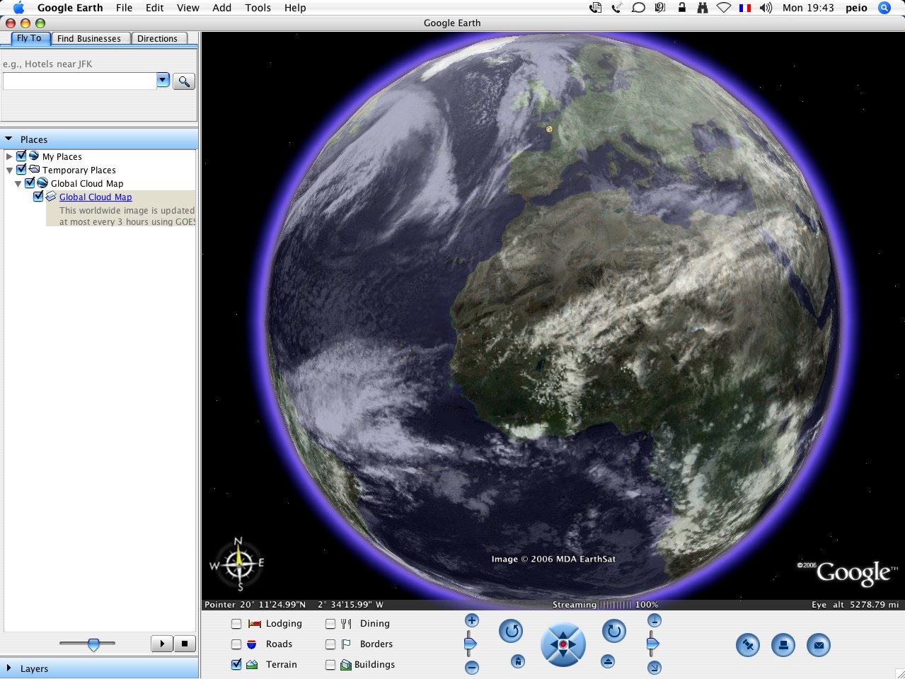
The new version 4.3 of Google Earth provides many new features, including the day/night effect a clouds layer, dynamic data of traffic, weather, news and more.
We've done several dynamic things already: traffic, weather, news courtesy of the New York Times, and YouTube. But don't wait for us to create more dynamic data - we've always believed that the greatest content is created by our users. Through the magic of Network Links in KML, any dataset can be set to auto-update at whatever interval is appropriate. The KML Gallery has several great examples, such as real-time earthquakes and current air quality.
Google Lat Long blog - News and Notes by the Google Earth and Maps team
you can now animate the Earth through different times of day! Check out how much more dramatic these hills look during sunset:
My favorite image is one of the Earth from space, overlaid with the cloud layer, and with the sun mode turned on:
If you're running the latest version of Google Earth, you'll notice a new "Weather" folder in the layers panel:
All the news that’s fit to print on a map: The New York Times in Google Earth
Real time Traffic in Google Earth
clipped from earth.google.com
Real-time Earthquakes
clipped from earth.google.com
Current Air Quality

blog it